
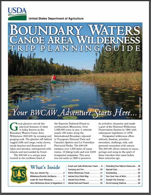
Boundary Waters Canoe Area Wilderness Trip Planning Guide
Excellent trip planning guide for the BWCAW: Boundary Waters Canoe Area Wilderness Trip Planning Guide created and shared by the USDA Forest Service.
FAQ from USFS
Click to open!
Excerpt from the guide: GREAT GLACIERS carved the physical features of what is today known as the Boundary Waters Canoe Area Wilderness (BWCAW) by scraping and gouging rock. The glaciers left behind rugged cliffs and crags, canyons, gentle hills, towering rock formations, rocky shores, sandy beaches and thousands of lakes and streams, interspersed with islands and surrounded by forest. The BWCAW is a unique area located in the northern third of the Superior National Forest in northeastern Minnesota.
Read more…