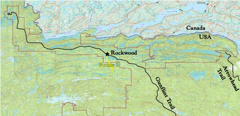
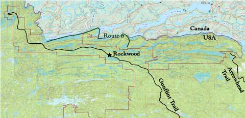
Rockwood Canoe Routes
Rockwood Canoe Routes are just a few of the possible canoe trips with varying degrees of difficulty and amount of time for completion. We will help you route your trip according to your personal needs and desires. Or, if you know exactly where you’re headed, we’ll just help you get there. Most of these can be reversed.
Listed below are some of the routes we use, along with descriptions of time needed to complete and degree of difficulty. Visit www.bwca.com for campsite ratings by other BWCAW visitors, and www.paddleplanner.com for help figuring out how long each leg will take. When using paddleplanner, click the explore button for detail info on portages and campsites; please support the developer by purchasing a subscription.
Related pages:

| Route | Entry Point (EP) | Entry Lake | Days | Difficulty |
|---|---|---|---|---|
| 1 | 49 – Skipper | Poplar | 2 | Moderate |
| 2 | 47 – Lizz | Poplar | 3 | Easy |
| 2a | 48 – Meeds | Poplar | 3 | Easy |
| 3 | 47 – Lizz | Poplar | 3-5 | Moderate |
| 3a | 48 – Meeds | Poplar | 3-5 | Moderate |
| 4 | 49 – Skipper | Poplar | 7 | Rugged |
| 5 | 50 – Cross Bay | Cross River | 4 | Moderate |
| 6 | 60 – Duncan | West Bearskin | 4 | Moderate |
| 6a | 58 – South | Topper | 3 | Moderate |
| 7 | 44 – Ram | Ram | 3 | Moderate |
7a | 45 – Morgan | Morgan | 2 | Easy |
| 8 | 43 – Bower Trout | Bower Trout | 7 | Moderate |
| 8a | 43 – Bower Trout | Bower Trout | 9 | Rugged |
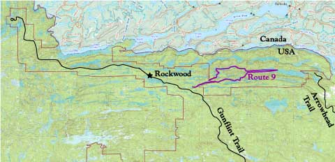
| 9 | 64 – E.Bearskin to Pine | East Bearskin | 3 | Moderate |
| 10 | 64 – E.Bearskin to McFarland | East Bearskin | 5 | Moderate |
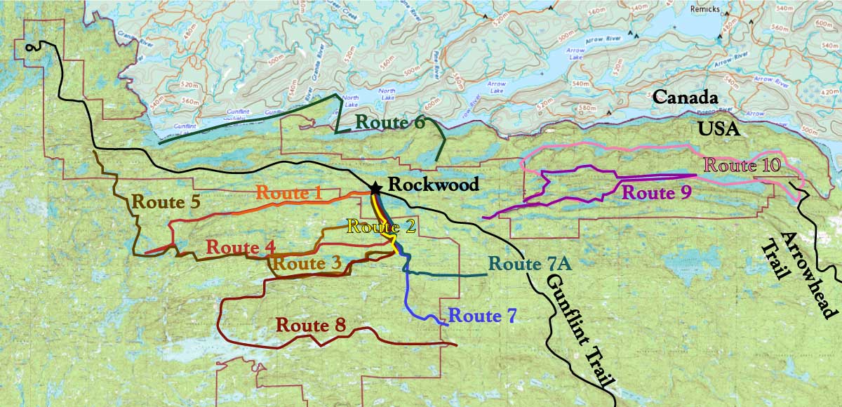
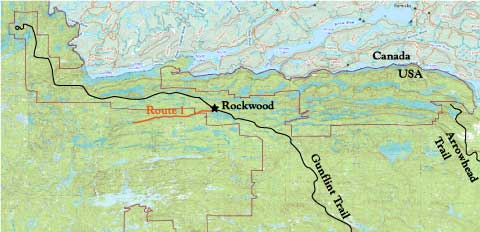
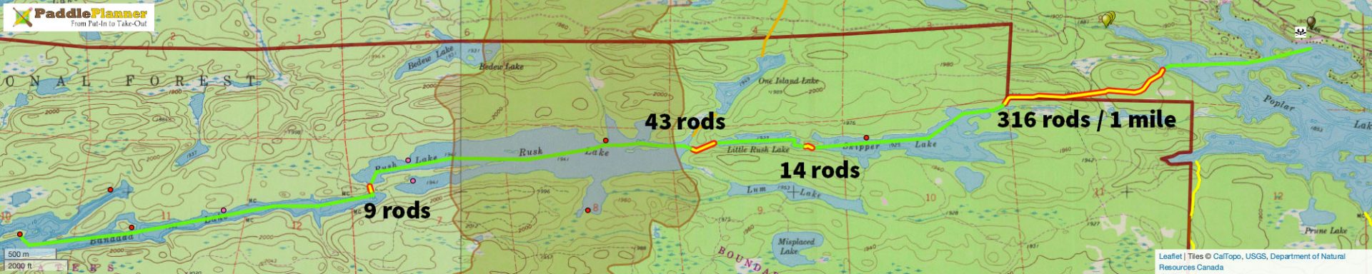
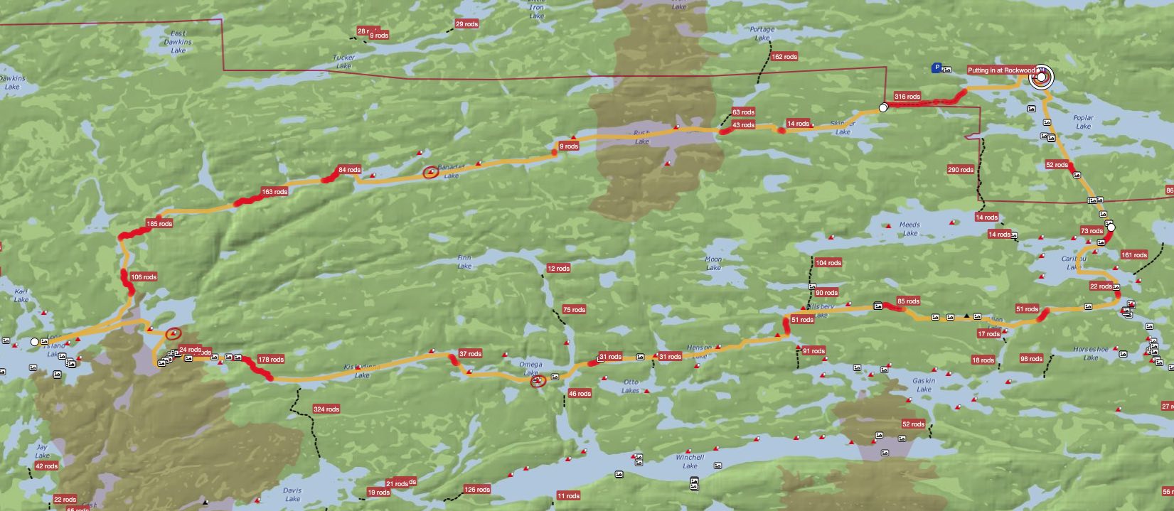
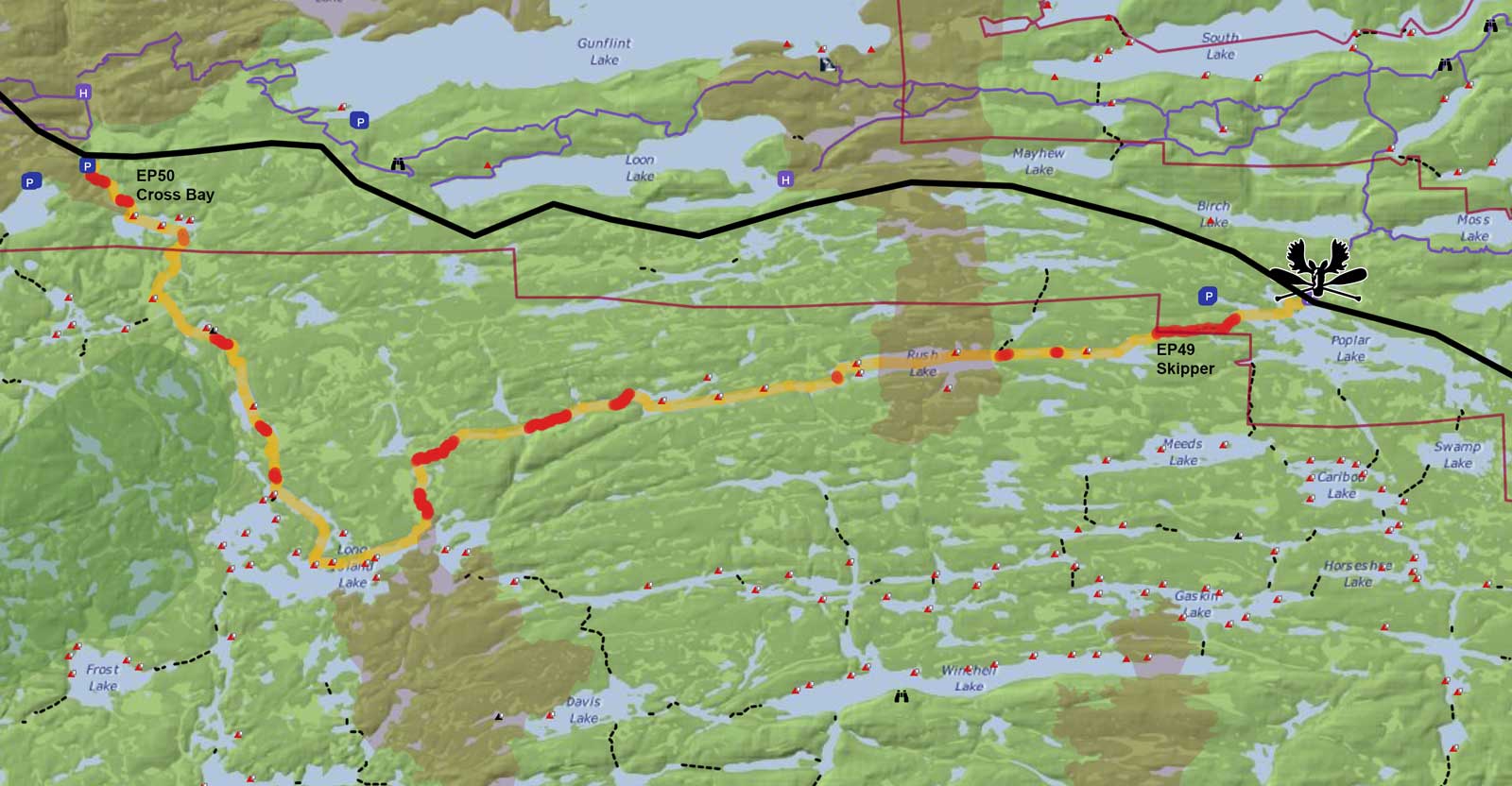
Route 1 Skipper to Banadad
Start at Poplar, go to EP 49 Skipper, Rush, Banadad, and return. Great walleye and northern pike fishing. Very scenic and remote. Two days average. Moderately difficult. View route on Paddle Planner.

www.paddleplanner.com <– click this for more details
Variation: Route 4 – Loop South to Long Island, Omega and back to Poplar via Lizz (minimum 4 days) link to paddleplanner.com.
Variation: Route 5 North – Start at Skipper but end at Cross Bay (requires transport)
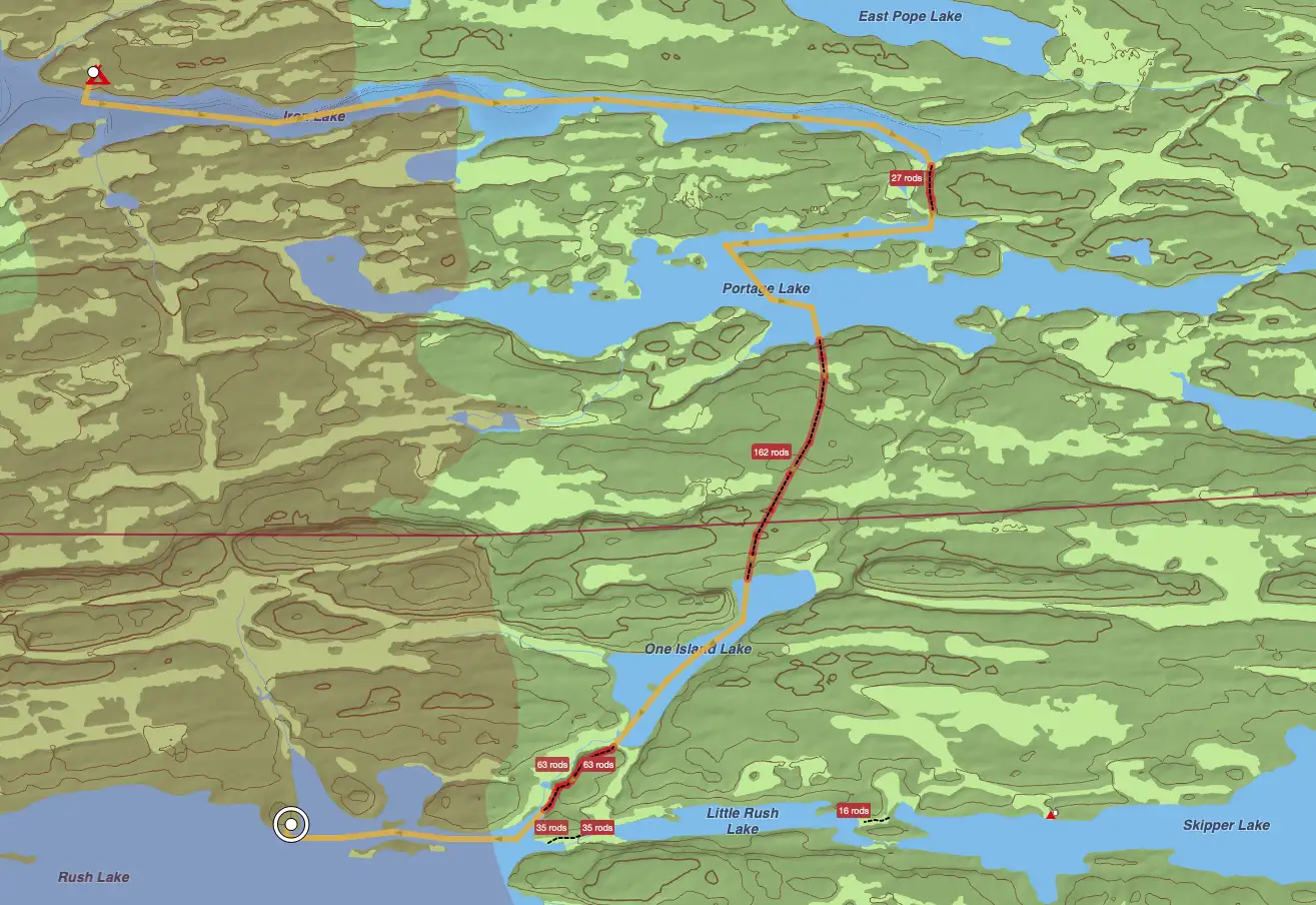
Variation: Route 1 starting at Iron Lake Campground, through Portage and One Island Lake, to Rush Lake.
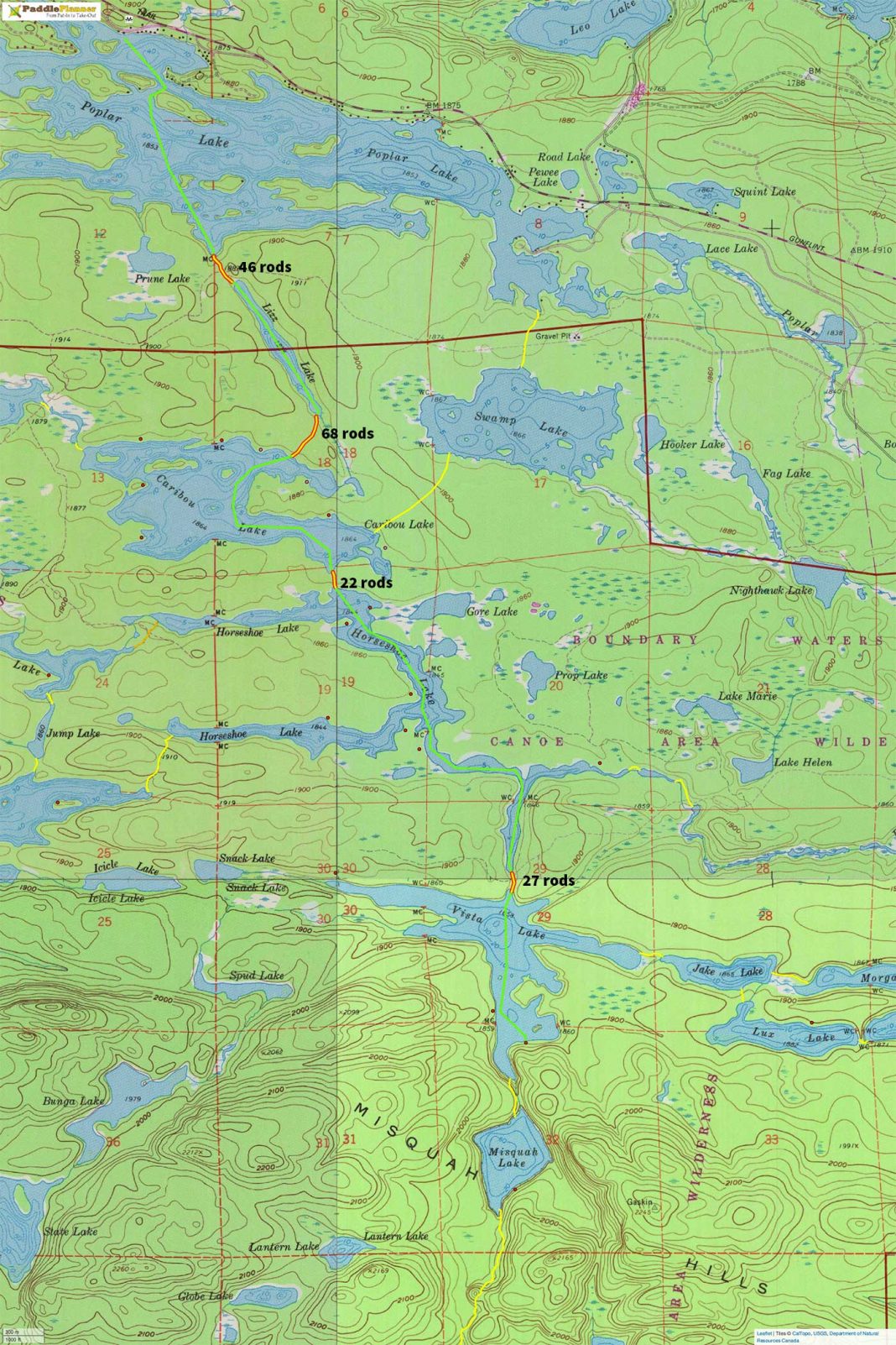
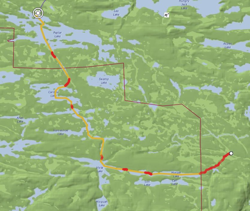
Route 2 Poplar to Horseshoe
Start at Poplar, go through EP 47 Lizz to Caribou, Horseshoe, Vista, and return. Super walleye and northern fishing. Beautiful country and short portages. Three to four days average. Easy. View route on Paddle Planner. Works as well using EP 48 Meeds.
ROUTE 2A: Vista via Meeds – Start at Poplar, go through Meeds to Caribou, Horseshoe, Vista, and return via Lizz. Super walleye and northern fishing. Beautiful country and short (after the first mile long one) portages. Two to three days average. Easy. – View route on Paddle Planner.
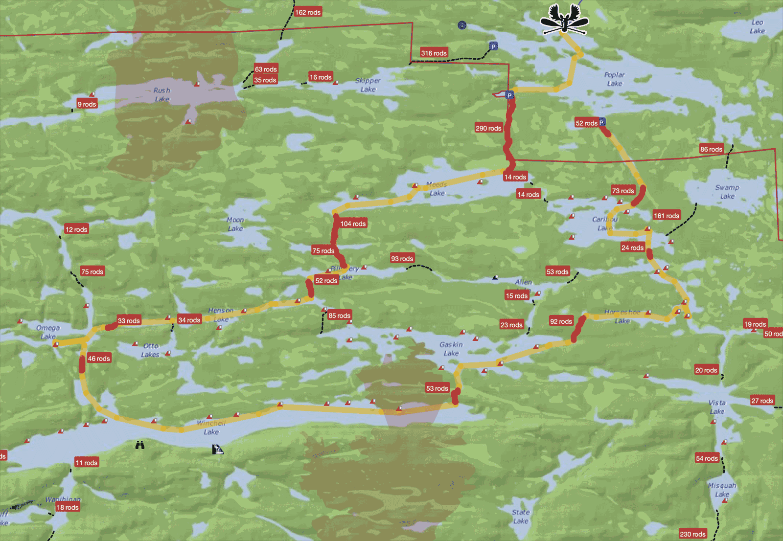
Route 3 Poplar Winchell Loop
Start at Poplar, through EP 47 Lizz, Caribou, Horseshoe, Gaskin, Winchell, north to Omega, Henson, Pillsbery, Meeds, and back through Caribou, Lizz, returning to Poplar. Winchell has a small hidden waterfall on the southern shore. Excellent walleye, northern, and trout fishing. Very scenic and remote with thirteen portages. Three to five days average. Moderately difficult. View route on Paddle Planner.
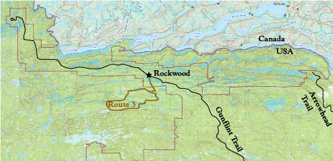
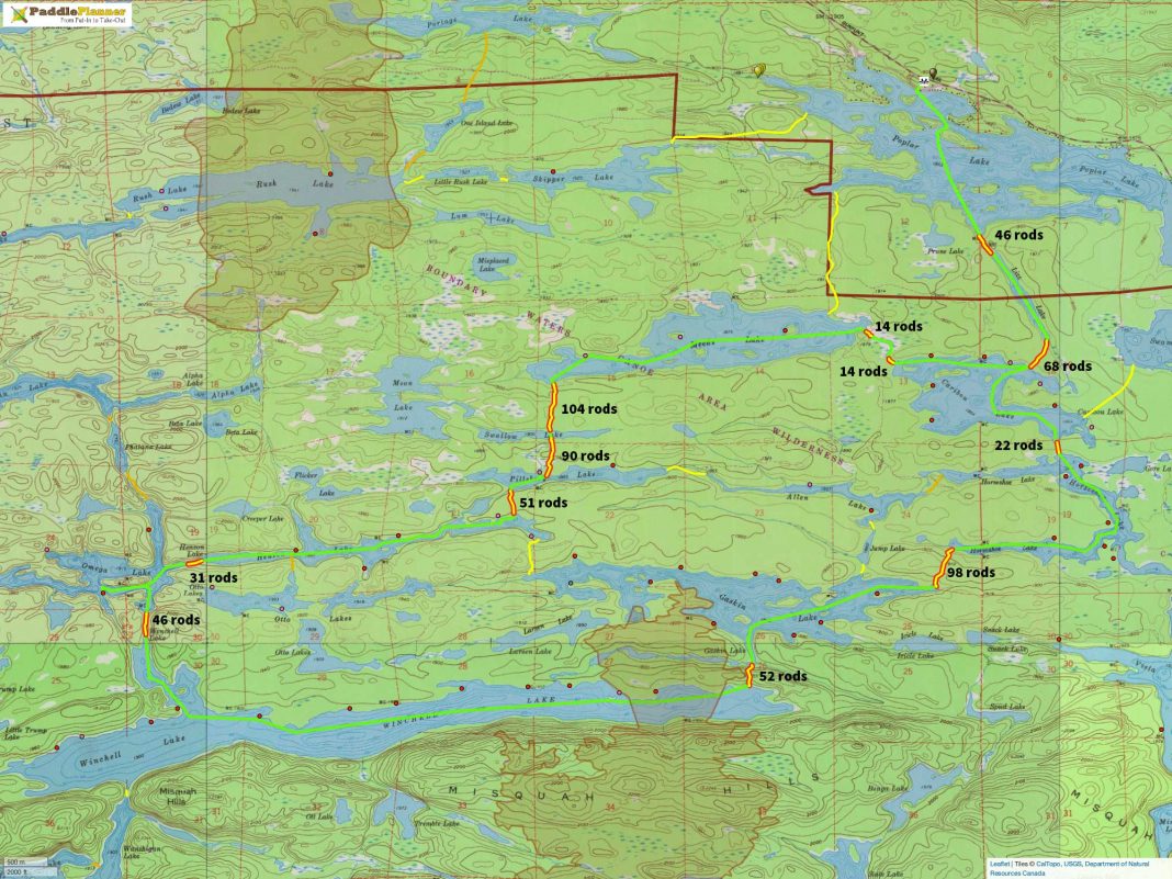
Route 3a: via Meeds
Route 3a: Start at Meeds EP, same lakes, same route. Three to five days average.
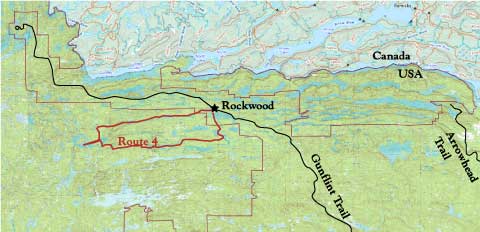
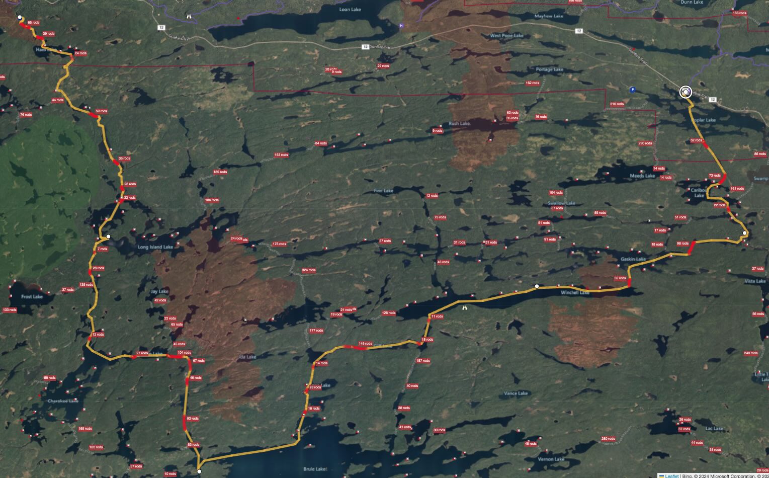
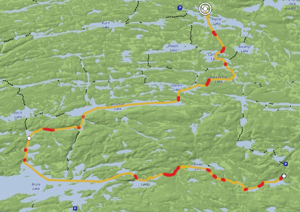
Route 4 Poplar Brule Loop
Start at Poplar, EP 49 Skipper, Rush, Banadad, Ross, Cave, Long Island, south to Gordon, Cherokee, Temperance Lakes, Brule, Cone Lakes, Cliff, Wanihigan, Winchell, Gaskin, Horseshoe, Caribou, Lizz and back to Poplar. Excellent walleye, northern and trout fishing. Winchell has a small hidden waterfall on the southern shore. Beautiful and very remote trip with twenty-seven portages, three are long ones. Seven days average. Rugged. View route on Paddle Planner.
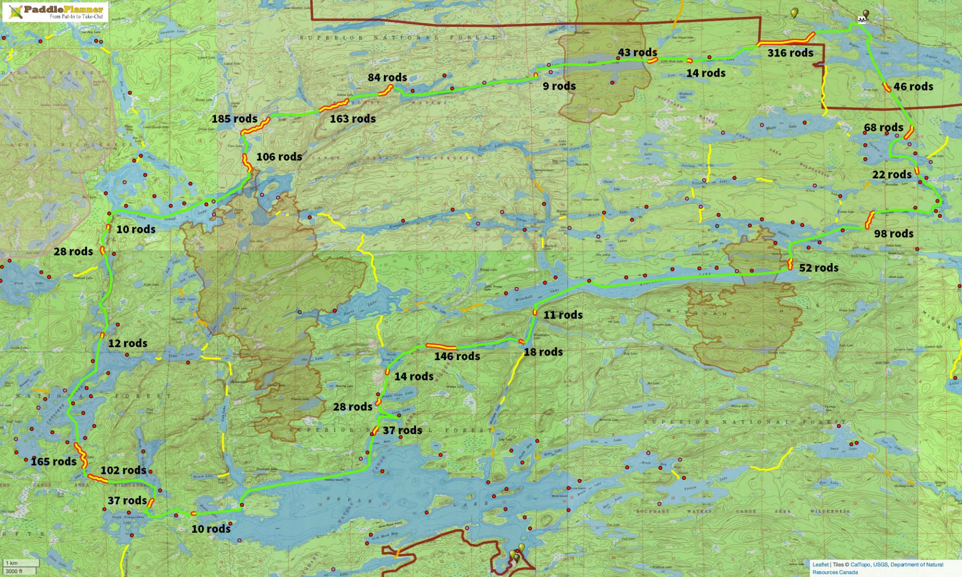
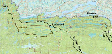
Route 5 Cross Bay to Poplar
Three variations on this route: North, middle and South.
5 – North Route
– Start at Rockwood, EP 49 Skipper, Little Rush, Rush, Banadad, Sebeka, Ross, Cave, Long Island, Karl, Lower George, Rib, Cross Bay, Ham, exit at Cross Bay EP 50 (Either direction works well) 3-5 days, easy. Route on Paddleplanner
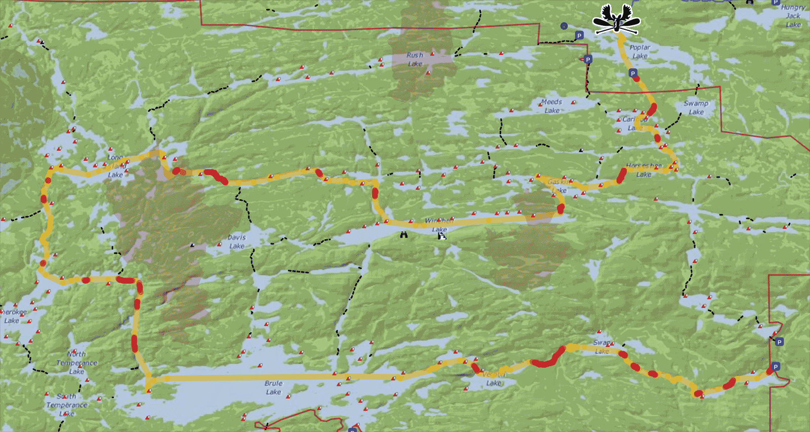
5 – Middle Route – Gaby and Werner:
If you can’t get Cross Bay EP 50 because they are unavailable, start at Missing Link EP 51 instead. Map: https://www.paddleplanner.com/s/s371pvco
We call it the Cross Bay – middle Gaby and Werner route: Cross Bay EP 50, no-name, Ham, Cross Bay, Rib, Lower George , Karl, Long Island, Muskeg, Kiskadinna, Omega, Winchell, Gaskin, Horseshoe, Caribou, Lizz and back to Rockwood Lodge on Poplar. Four to Seven days. Route on paddleplanner.
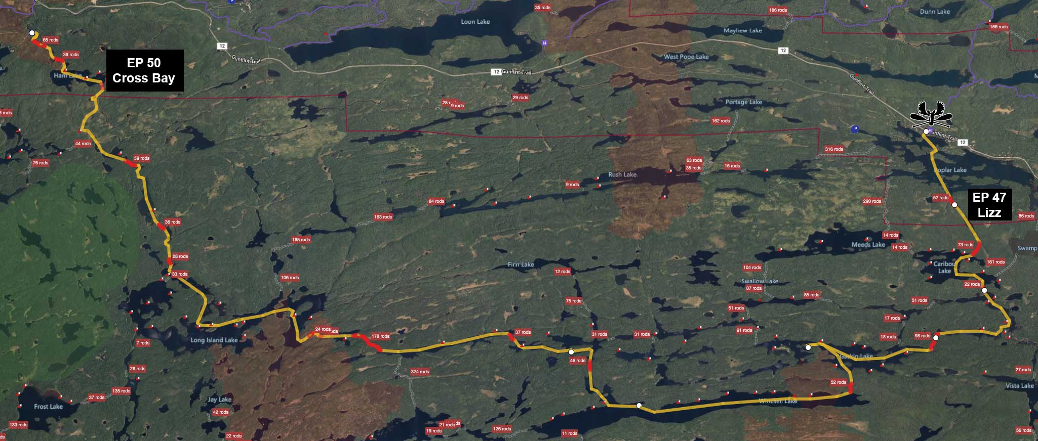
5 – South Route
Cross Bay EP 50, no-name, Ham, Cross Bay, Rib, Lower George , Karl, Long Island, Gordon, Cherokee, Town, Vesper, Cam, Brule, Cones, Cliff, Waninigan, Winchell, Gaskin, Horseshoe, Caribou, Lizz and back to Rockwood Lodge on Poplar. Five to Seven days plus. Route on paddleplanner.
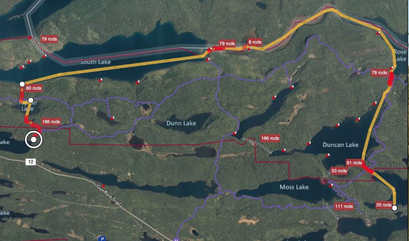
Route 6 Duncan Stairway Portage
Waterfall!
Scenic route that includes the Stairway Portage, rose falls and Rose Lake. Start at EP 60 on West Bearskin Lake, to Duncan, Rose, Rat, South, North, Little Gunflint and finishing at Gunflint. Includes the famous Stairway Portage and is part of the Voyager Highway route along the Canadian border. Seven portages. Four to seven days average. Moderately Difficult.
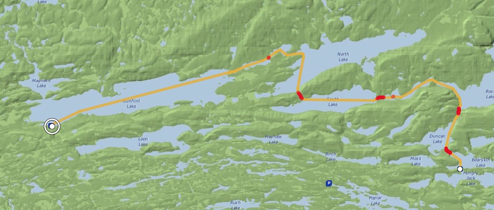
Route 6a Topper to Duncan
(Permit starts at South and exits at Duncan) – The main Entry Point for EP 58/South Lake is on Gunflint Lake, then to Little Gunflint Lake, North Lake, and then South Lake. Another option is to start at Mayhew/Topper, enter EP 58 through Topper to South, continue to Rat, Rose, Duncan, West Bearskin, and exit at the EP 60 trailhead on Hungry Jack Road near Hungry Jack Lodge. Total route is 3 to 5 days.
Two significant portages on this route: the portage from Topper to South descends 262 feet and is 1/4 mile long, or 80 rods; the Stairway Portage from Rose to Duncan climbs 164 feet on stone steps, and is just under 1/4 mile long, or 78 rods.
Route on paddleplanner.
Do NOT park at Mayhew/Topper; one method is to leave your vehicle at the exit on West Bearskin (Duncan EP 60) and get a transport to Mayhew/Topper. There is parking at Gunflint for EP 58 South Lake, at the public landing.
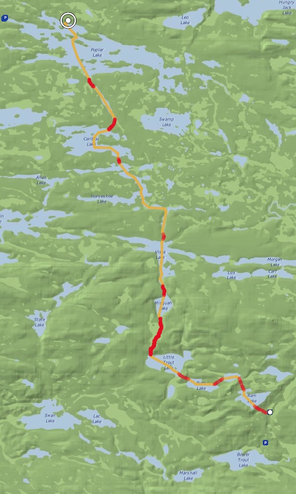
Route 7 Ram to Poplar
This trip starts at EP 44 Ram Lake to Kroft, Rum, Little Trout, Misquah, and Vista, continuing through Horseshoe, Caribou, Lizz and back to our dock at Poplar Lake. This remote trip goes through scenic Misquah hills and offers many opportunities for side trips. Three days average. Moderately Difficult.
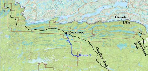
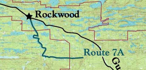
Route 7a Morgan to Poplar
This trip starts at EP 45 Morgan Lake to Jake and Vista, continuing through Horseshoe, Caribou, Lizz and back to our dock at Poplar Lake. This trip offers many opportunities for side trips. Two days average. Easy. Mile long portage that starts on the Lima Grade forest road. Google map of driving directions.
Route 8 Bower Trout
Bower Trout to Poplar. Start at EP 43 Bower Trout, go through Marshall, Dugout, and Skidway, on to Swan and Vernon, continuing to Brule Lake; Through the Cones, Cliff, Wanihigan, Winchell, Gaskin, Horseshoe, Caribou, and Lizz, returning to Poplar. Twenty-two lakes, remote with good fishing and wildlife. Seven to ten days. Rugged. Side trips to Omega, Henson, Pillsbery, Allen.
An alternate is just to start and end at Bower Trout, go in Swan or Brule and come back out. Two to three days, moderate.
Route 8a – Bower Trout to Rockwood via Long Island Lake
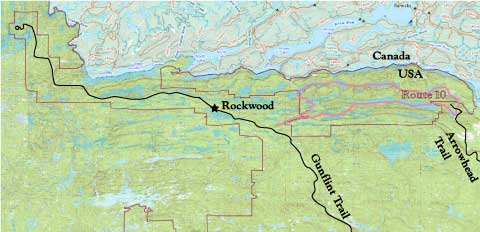
Route 9 East Bearskin to Pine
Waterfall!
Start at EP 64 East Bearskin, travel east on a circular trip to Alder, Canoe, Pine, and returning through Little Caribou, Caribou, Deer, and Moon, ending at East Bearskin. Johnson Falls is accessible near Canoe and Pine Lake portages. Excellent bass, walleye and northern fishing. Three to five days average. Moderately Easy.
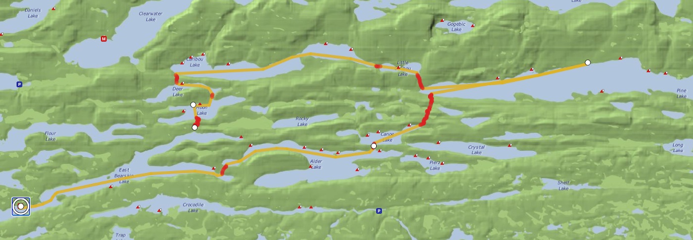
Route 10 East Bearskin to McFarland
Waterfall!
East Bearskin to McFarland Loop. Start at EP 64 East Bearskin, through Alder, Canoe, Pine, McFarland, Little John, and John, back through East and West Pike to Clearwater, Caribou, Deer and Moon returning to East Bearskin. Johnson Falls is accessible near Canoe and Pine Lake portages. Good fishing, very scenic! Five to seven days average. Moderately Difficult.