Unpredictable Weather–Everybody Talks About It, El Nino Does Something About It
—
The National Oceanic and Atmospheric Administration (NOAA) declares that “from heavy snow to strong winds and mixed precipitation, the 2022-2023 winter season was one for the record books!”
Last winter’s weather saw snow totals of 12 to 15 feet here at the entry to the Boundary Waters Canoe Area Wilderness (BWCAW), putting us into the top ten snowiest winters on record. With a winter affected by the La Nina climate event, one would have expected record-low temperatures as well. But the result was a warmer-than-average winter.
NOAA and other agencies track the snowfall year from July 1 to June 30, so we won’t know how this current weather compares for a while. But if we set records this year, it won’t be for the most snow or the deepest cold. It’ll be the opposite.
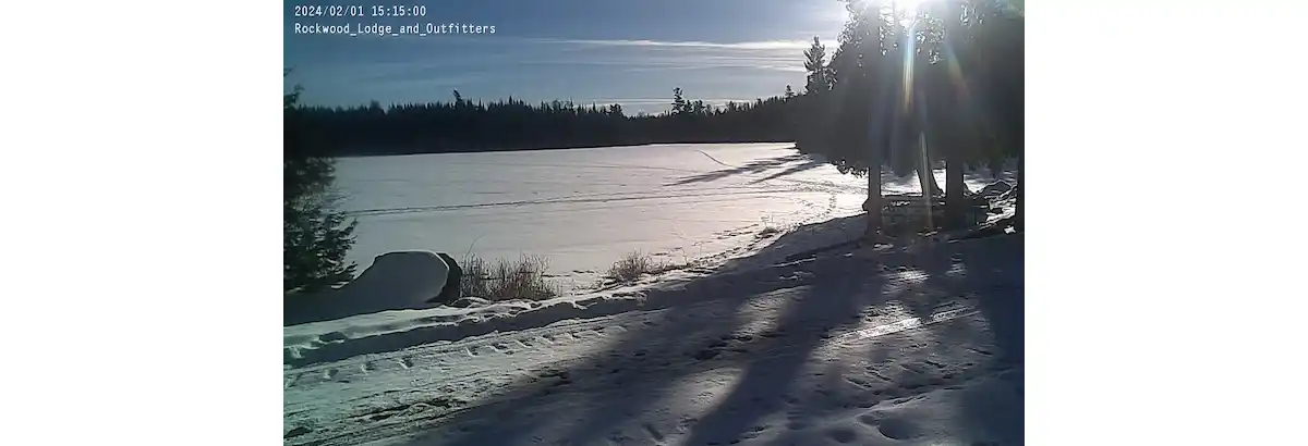
Link to current webcam
With warmer temperatures and few significant snowfalls here, it’s important to note that the latest measurable snowfall in Minnesota, 1.5 inches, occurred in Koochching County on June 4, 1935.
So, there’s still hope.
On its Facebook page at the end of January, the National Weather Service (NWS) in Duluth published an analysis of the snowpack in its region. Looking at snow depth and snow water equivalent (the amount of water held in the snow), they conclude that the snowpack in January is less than 10% of normal.
The effects of weather with little snow and warm temperatures have profoundly affected our region.
Two major dogsled racing events, The John Beargrease Sled Dog Marathon scheduled for last week, was canceled early this month.
The Gunflint Mail Run sled dog race was postponed from its early January start and planned for next week. That race has been canceled as well.
Snowmobile and cross-country ski trails are being maintained as well as possible.
We need snow.
Cascade State Park, along the shore of Lake Superior in Lutsen, reported on January 25 that their trails have a base of less than three inches, and both ski and snowmobile trails are closed.
After three years of El Nina, her bigger brother, El Nino, took over our weather this October in an unpredictable but repeating pattern.
El Nino arises from warmer than normal surface waters on the equator that flow up the central and eastern part of the Pacific Ocean, and he hangs around for nine months or more.
Changing global wind patterns bring El Nino to our region, producing warmer winters with less snowfall.
To some extent, this warmer winter is also a result of ongoing climate change. The Minnesota Department of Natural Resources (DNR) reports that “In Minnesota, a typical winter day is now several degrees warmer than in the middle of the 20th century, and average low temperatures during January, our coldest month, have increased by over 10 degrees F in some areas.”
We are living with a snow drought this year. From the drought.gov website comes this description, “According to the AMS Glossary of Meteorology, snow drought occurs when there is a period of abnormally low snowpack for the time of year in question.”
The snowpack acts as a reservoir of fresh water for our region. Because of the drought, concerns arise about how the upcoming Spring runoffs will fare and how the lake and river levels will be impacted, not to mention our fantastic waterfalls.
Let’s conclude this piece on an optimistic note.
Minnesota weather has always been unpredictable. This is what we mean when we say, “Ahh, this is typical Minnesota weather.”
There is still plenty to do here on the Gunflint Trail.
- Some of our neighbors have created great ice skating rinks.
- There’s availability in Cabin 12 in February and March – https://www.rockwoodbwca.com/cabins/cabin-12/#bookcabin
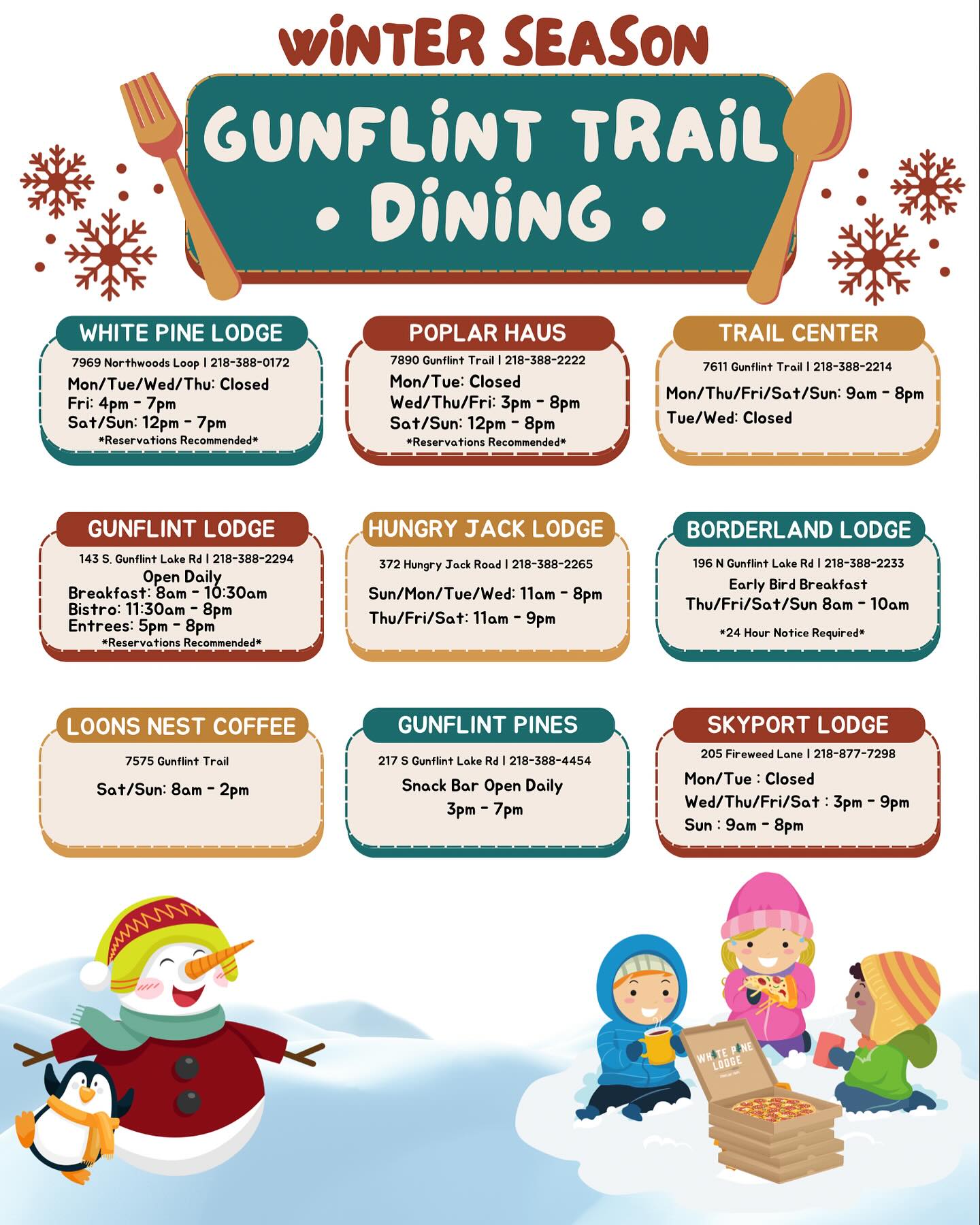
- Local restaurants are open and ready to delight you with great food and a good time. (See the winter dining guide).
- Bearskin Lodge and Golden Eagle Lodge keep our ski trails open and groomed here.
- Banadad cross country ski trail goes right through BWCAW, take your dog skijoring
- Gunflint Lodge and Outfitters offer sleigh rides through the woods powered by a pair of friendly and beautiful Clydesdales.
- Come up and see all of us here on the Gunflint Trail and enjoy a truly unique experience during a rather unusual winter.